For our last full day, the objective was to go into Waterloo itself, a few miles north of the battlefield, to check out the Wellington Museum and the church opposite. Getting there was easy - we scrounged a lift, which was very useful!
After our military investigations, we had an excellent lunch in a terrace cafe in Waterloo, then caught the bus back to Braine l'Alleud and walked past the Lion and La Haye Sainte, along the Allied line, to have a look at the farm at Papelotte.
As in the previous instalments, I'll try to build an outline narrative in the captions to the pictures.
The Wellington Museum in Waterloo; Wellington made his HQ in the hotel in the village. I believe this photo shows his bedroom, and his bed, in which his ADC, Alexander Gordon, died after the battle. The soldier is an officer of the 42nd Foot; what he's doing there is unknown to me
Wellington at his desk, writing his report of the victory. The decor of the room includes a portrait of himself, over the fire, which seems like vanity, and in the window there is a bust of him about 30 years later, which is downright weird
The Museum has all sorts of exhibits - here are some Allied soldiers
I assume this is genuine, and they pinched it off the wall of the Belle Alliance inn, later night club
Back in the weird department; this is one of Lord Uxbridge's prosthetic legs, which obviously postdates the battle. Unless, of course, the correct quote was, "My God, sir, I've lost my wooden leg..."
For those with uneasy memories of wobbling up the Mound, here it is in Lego - there is no escape
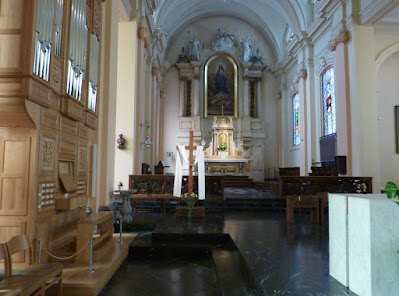
Directly opposite the Museum is the church. The domed structure at the front was built later than the battle. In 1815, most of the main street of the village appears to have been wooded
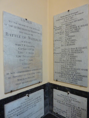
Inside the church is a remarkable collection of British memorials; these are worth a study in themselves
In passing, I observe the memorial to Alexander Hay, of Nunraw, which place is up in the hills above the East Lothian village of Garvald, about 10 miles from where I am sitting typing this
My last picture of Waterloo, the town, is a view of the Wellington Museum, taken from the church steps
OK - after our lunch, and a bus ride back to the battlefield, we set off along the ridge line, east towards Papelotte. Here we have just started; we are a short distance along from the crossroads, La Haye Sainte is just the other side of the clump of trees on the right, which are close to the site of the sandpit. At this point the crest of the ridge is just in front of us, but you can see how much undulation there is in the valley ahead. The grand battery is somewhere on the green ridge in the distance
Another French monument; if you can make out the text, it becomes apparent the word "héroiquement" is one of a series of euphemisms which mean "unsuccessfully"
We are looking across towards Plancenoit here
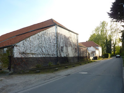
This is Papelotte Farm. The present buildings are all later than 1815 (I think the place was destroyed); we are south of the farm buildings, and the lane is sloping back up towards the main Allied ridge line
More of Papelotte - again, we are on the French side of the buildings
From this point, the view south towards Plancenoit has an uphill slope, and the terrain to the east changes abruptly into something like bocage - hills, twisty lanes with steep banks - very different to the main battlefield
We followed the lane south from Papelotte, the Chemin de Marache. We were trying to get to the battlefield locations of La Haye and Fichermont, which are marked on the old maps, to the south-east of Papelotte, and close to it.
First interesting fact was that we read that the chateau of Fichermont was destroyed years ago, and its remains have been buried under the roots of a wood. OK - we'll just look for evidence of the name, then. Second interesting fact was that it turns out that Marache is the modern name of Smohain, which place is definitely on the old battlefield maps. The next few photos, then, are of the village which used to be Smohain
Fichermont may not exist, but here's a lane that used to go there!
Now we have turned west, on the Route de Marache, and are leaving the village, which should take us past La Haye (wherever that is) and back to the end of the lane up to Papelotte
We pass a serious looking farm, which is too modern for 1815, and is on the wrong side of the lane to be La Haye...
...here's the big house and the front gate...
...but here, opposite, on the other side of the lane, is a house which is also too modern, and is now a Gingko Centre or something - but this building appears to be on the site of La Haye, so we (sort of) found it! Continuing along the lane to the west, in about 50m we came back to the lane end at Papelotte, so we had completed our loop
That is all my photos for this trip. The following day we were fully engaged in travelling to Brussels and catching a plane home - Brussels Airways this time - so my camera was safely locked away in my luggage.
A couple of thoughts.
We spent a lot of time during our stay discussing the detail of the terrain. There has been much surmise and legend over the years about the significance of the ground conditions at Mont St Jean. We observed, even in the fine weather which blessed our visit, that the fields at the bottom of the shallow valley between the French and Allied positions were distinctly marshy in places, you could see it to the east of the main road, near La Belle Alliance. In really wet weather, it looks as though it might have been a problem for moving artillery, and D'Erlon's boys would be fairly squelching along in the low ground.
The Archduke, looking at the diorama in the Battlefield Museum, asked a very interesting question. It does seem odd that the French army committed so much time and effort to banging their heads against Hougoumont. If Napoleon really wanted to "tease" the Allied right, why didn't he just bypass Hougoumont and swing around it? It would be interesting to know how Wellington would have reacted, in view of the implied threat of a push towards Hal, and maybe Ghent, jeopardising the British line of retreat to Ostende.
For me, Hougoumont is a puzzling bit of the battle anyway; did Napoleon simply give the order to attack, and forgot to tell them when to stop? Quite a lot of the French strategy on the big day looks very like wishful thinking.


