 |
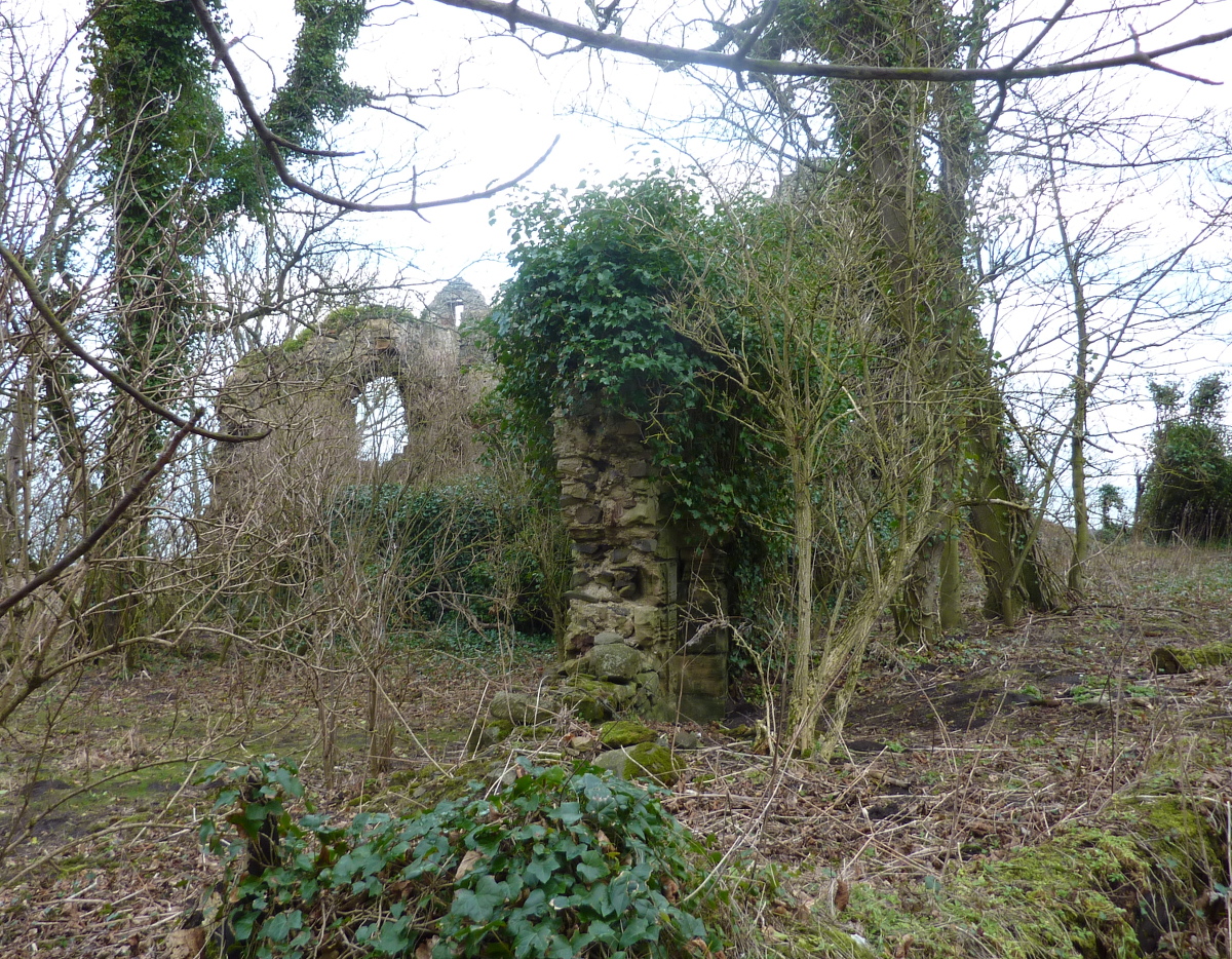
| Auldhame Castle as it is today, on the edge of a cliff - view from the North West |
Auldhame Castle was a fortified house built, probably on or near the site of an earlier building (which may have been some form of religious retreat - see later), in about 1530, by Adam Otterburn of Reidhall, who was sometime Lord Provost of Edinburgh (from 1538 until his term of office was ended by the Rough Wooing), Lord Advocate to James V of Scotland and later secretary to James' second wife, Mary of Guise. Adam was murdered in Edinburgh in 1558.
Since he also had a residence at Reidhall (or Redhall), in Edinburgh, Auldhame may have been the family farm or a country seat, but it was a substantial structure. It was an L-shaped building - the North wing faced onto the cliffs over the Forth, on the East Lothian coast, and much of that is still standing and recognisable; the South-East wing has mostly disappeared - about all that remains is the entrance door.
 |
| Trouble with neighbours? - Tantallon, the seat of the "Red" Douglas family, is just across a field and a little bay from Auldhame. Since Otterburn advised James V on a treason charge against the Douglas household in 1528, it seems odd that he chose to build next door to them. The field in the foreground is called Old Adam, and it is here that the burial ground was discovered in 2005 - I had read that "Adam" was a corruption of Auldhame, but I prefer to believe it is named after old Adam Otterburn |
 |
| Entrance to the vanished South wing |
 |
| This photo is borrowed from elsewhere - note the cloverleaf motif |
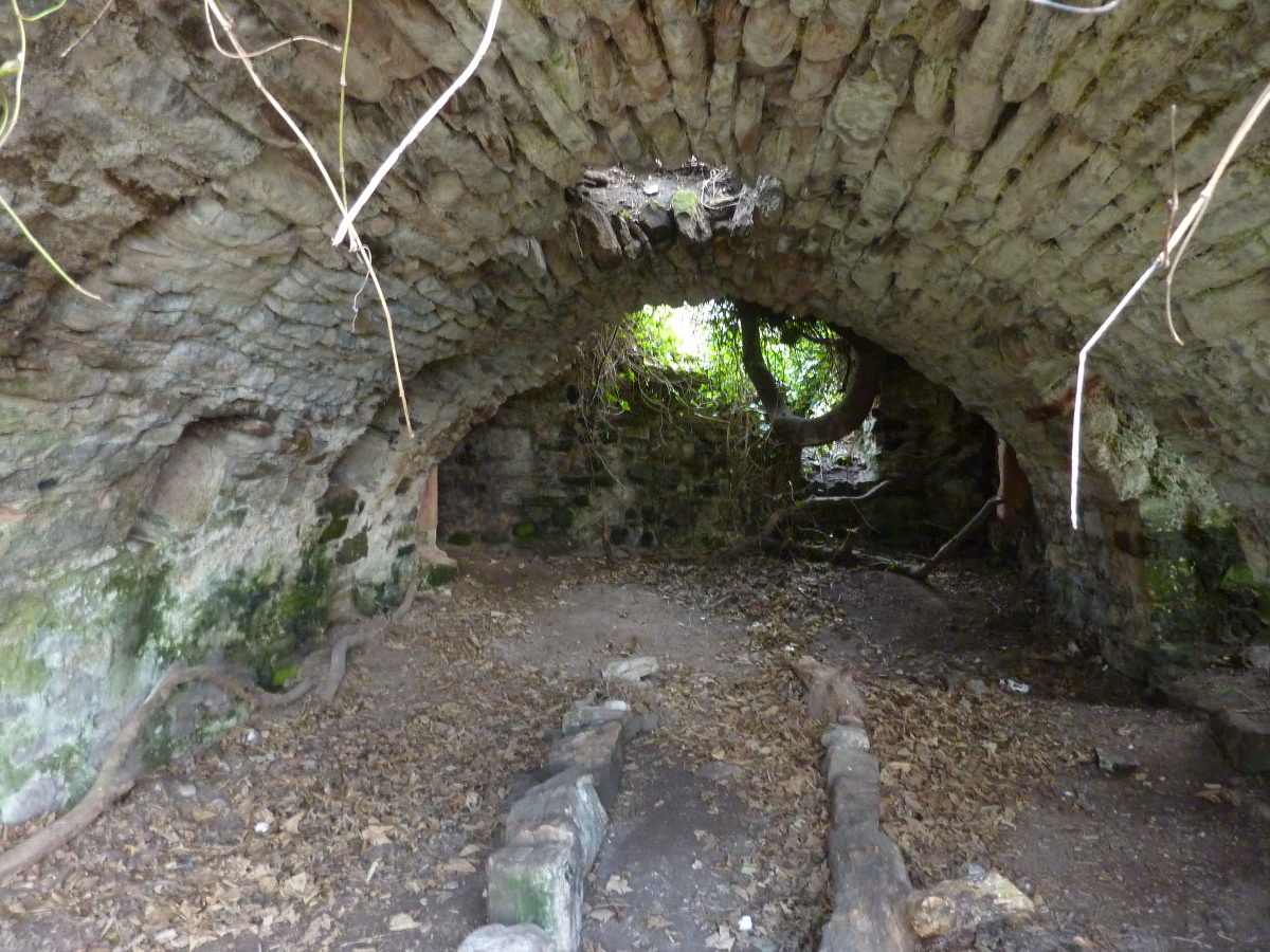 |
| Vaulted cellar area below the remaining building |
 |
| In these parts, the ivy always wins in the end |
 |
| Good heavens - could that be a ghostly hand waving - can you see it too...? |
 |
| The flat area on which the house was built is bounded by a bank (and the footings of an old wall, somewhere under the trees), built on top of a sandstone face |
 |
| The ground is hard to figure out, because of the subsequent growth of the forest, the progressive collapse of the cliffs in front of the house, building of more recent walls and field structures and a fair amount of anti-tank defences left over from WW2 - the beach here was a source of constant worry as an invasion site (from Norway?) |
 |
| This is not a sandstone cliff - it is WW2 concrete! |
 |
| Just as a reminder, this is what it is supposed to have looked like around 1600 - viewed from the same angle as my first photo - the cliffs were further away then! |
Would that be Redhall House in the Dell in Criglockhart?
ReplyDeleteAlan
ps great photos
Hi Alan - yes - the same. I used to live at Morningside in Edinburgh, and used to go for Sunday walks to Colinton and Craiglockhart and that area. Long time ago now!
DeleteGreat stuff, well done! Keep up the good work!
DeleteSneaky, these Scots, hiding their castles in the woods like that.
Chris - I have yet more relatives who live in Eyemouth - whereabouts is your bastion/ditch? which headland?
DeleteLooks like a fascinating destination for a ramble. Who owns the site now, is it private or some sort of historical designation?
ReplyDeleteThe period illustration has a quality of pretension about it - I am sure it could have been defended in a pinch, for a while, but it the fortifications already have a decorative quality to them.
Hi Michael - it's just an old ruin in the woods on the farm's land - the same family (Dale) now own the adjacent farms of Auldhame, Seacliff, Scoughall, New Mains and Lochhouses, which basically is all the coastal land between Tantallon and the Tyninghame estates at the mouth of the River Tyne (the Scottish one - no relation to the Northumberland one) - the first three named farms are simply treated as a single ranch now. There is another, more modern ruin at the other end of the same wood. I've got used to it, but this is a rather unusual place to live. One way or another, if you go down in the woods, you're sure of a big surprise...
DeleteIt looks as though Auldhame Castle didn't last too long - maybe 100 years start to finish. I think by the mid 16th Century these places wouldn't be expected to do any serious defending - I guess this was just a posh house for a big Edinburgh statesman, from which to pull tongues at the neighbouring Douglases.
DeleteI don't know how Mr Spratt knows it was yellow - maybe they were all yellow...?
There now. It's the headland across the bay to the NW from the harbour entrance, next to Eyemouth Holiday Park.
ReplyDeleteHold on, I'll see if I can overcome my luddism and scan and email you the 1549 plan when I get home from work, to compare with the Google Earth image.
Tony,
DeleteLord, I hate bloody technology.
With a lot of luck, you should have received a couple of emails with the 1549 plan and a modern satellite pic of the fort at Eyemouth. I had to eventually admit defeat and get the missus to take a scan of the plan - she understands this stuff better than me.
I am now going to go and lie down in a dark room.
Documents received - interesting - thanks...
DeleteMy people will be in touch.
What a lovely spot for a walk around - these old sites are fascinating.
ReplyDeleteIf you can see the hills it's going to rain; if you can't then it is already raining.
DeleteVery interesting, thankyou. My ancestors lived at Whaupknow, about a mile or so from Auldhame from 1730-1750s approx. Whaupknow disappeared when Robert Colt bought & developed Seacliffe House. If you find evidence of Whaupknow's existence I'd love to hear!
ReplyDeleteAlan - thanks for getting in touch - could you please email me at the address in my blogger profile? I have part of an old map which shows Whaupknowe between Auldhame and Scoughall (all modern spellings). I've contacted a friend of mine from the family who own Seacliff, Scoughall and Auldhame farms - he knows a bit about the history, and also knows some local historians. Where are you based now?
DeleteAlan - supplemental - the chap from the farming family confirms that this farm used to be called Whaupknowe, which is Scots for "Curlew Hill" - whaup being the lovely Scottish onomatopeoia based on the sound of a curlew. The name Seacliff was introduced by the Colt family around 1750, and they took over the neighbouring farms of Auldhame and Scoughall, which had their own fortified towers and lairds before that. He also said that if you could get in touch with me he'd be delighted to learn more about your ancestors, so please email me if you can do so.
DeleteThanks again for sparking this off.
...in case I didn't explain this properly, Whaupknowe is where I'm actually sitting typing this! [and I never knew]
DeleteWell, I certainly didn't expect a response as swiftly as this! What a wonderful link. As invited, I shall email you.
DeleteHello, again - I emailed you a few days back. As I've had no response I'm wondering if I've picked up the correct address. Did you receive my email?
DeleteAlan - no - noting received, not as Spam, either, and no notification of rejected messages. The email address in my Blogger profile is (obliquely, to keep the bots at bay) msfoy AT btinternet.com.
DeleteIf you email me on that it will be forwarded to my main email a/c, and I'll reply from there.
Regards - Tony
Thankyou! On checking I think I failed to email you correctly. I've written another & have just sent it from my usual provider. Hopefully all OK now!
DeleteAlan.